Map - Detailed Empire
Wildwinter (talk | contribs) No edit summary |
mNo edit summary |
||
| (8 intermediate revisions by 2 users not shown) | |||
| Line 1: | Line 1: | ||
==Overview== | |||
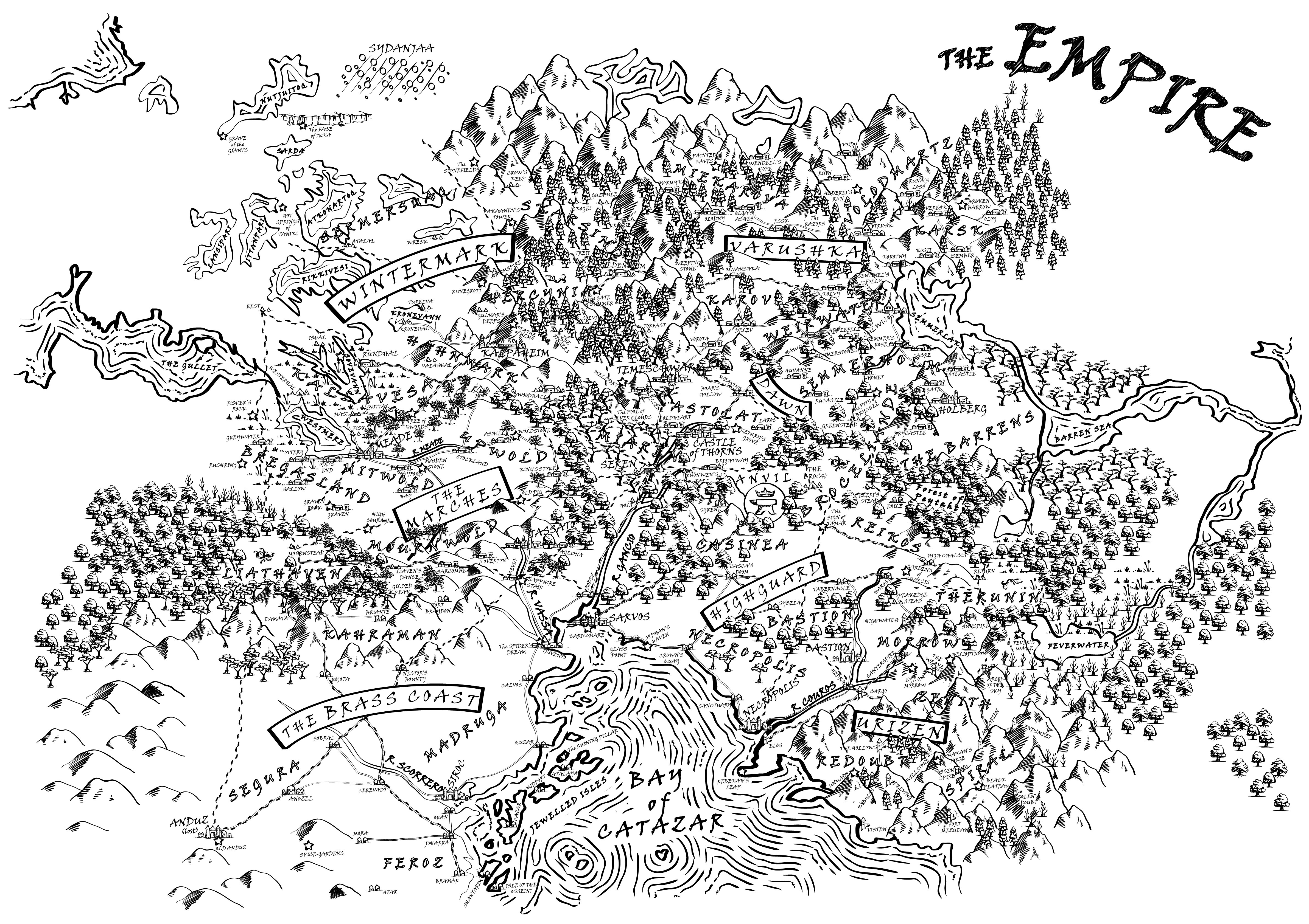
This map is appropriate to the Empire prior to Winter 381YE. A more up-to-date version of this map can be found on the [[maps]] page. | |||
It may be helpful to browse the [[Gazetteer]] while reading the map - it gives details of the various settlements and places of interest. | Click on this map to view it in detail. You may need to click again to zoom in on your browser. Believe me, you need to zoom in... | ||
Alternatively, you can take a look at [http://larp.me.uk/PD/empire/map/ Nicholas Avenell's wonderful zoomable Google version of the Empire Map]. | |||
It may be helpful to browse the [[Gazetteer]] while reading the map - it gives details of the various settlements and places of interest. For usual pronunciation, see [[Pronunciation guide|here]]. | |||
In scale, this map is around 900 miles north to south. | In scale, this map is around 900 miles north to south. | ||
''Map by Daisy Abbott.'' | ''Map by Daisy Abbott.'' | ||
[[File:Map-illustrated-superdetailed-MASTER-colour-e4-2017.png|640x448px|link=http://www.profounddecisions.co.uk/mediawiki-public/images/0/0d/EmpireDetailedMap.png]] | |||
[[Category:Maps]] | [[Category:Maps]] | ||
Latest revision as of 11:44, 6 November 2017
Overview
This map is appropriate to the Empire prior to Winter 381YE. A more up-to-date version of this map can be found on the maps page.
Click on this map to view it in detail. You may need to click again to zoom in on your browser. Believe me, you need to zoom in...
Alternatively, you can take a look at Nicholas Avenell's wonderful zoomable Google version of the Empire Map.
It may be helpful to browse the Gazetteer while reading the map - it gives details of the various settlements and places of interest. For usual pronunciation, see here.
In scale, this map is around 900 miles north to south.
Map by Daisy Abbott.